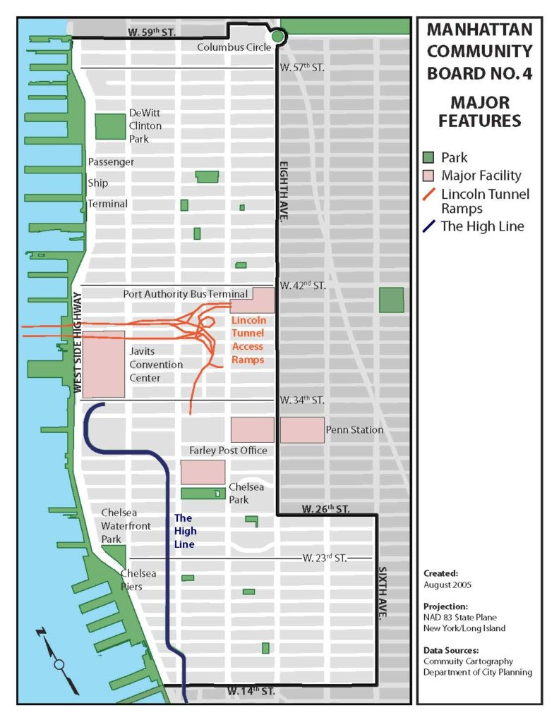
Manhattan Community Board 4 comprises the area between 14th and 59th Streets – to the west of Eighth Avenue north of 26th Street, and to the west of Sixth Avenue south of 26th Street, commonly referred to as the Chelsea and Clinton/Hell’s Kitchen neighborhoods, as pictured in the map below.
District Overview
Manhattan Community Board 4 – District Profile
Additional Links
Various maps have been created as resources for New Yorkers to allow them to stay geographically connected to the city.
A free online database created by New York City agencies and other partners to obtain information 311, building, and crime complaints/reports, and etc.
A demographic map that represents the different demographics of Chelsea & Clinton neighborhoods.
Board Stat displays NYC 311 service request data by Community Board.
The 311 Portal can provide information on service requests that have been submitted.